Civil Surveying with Commercial Drone
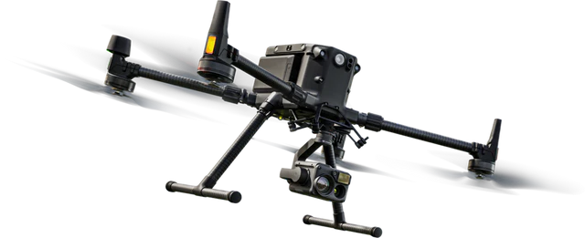
Unmanned Aerial Vehicles (UAVs), commonly referred to as drones, have transformed civil surveying by offering rapid, high-resolution spatial data collection at reduced costs and enhanced safety (González‑Jorge et al., 2017). Initially deployed in military and atmospheric research, their civilian applications now span surveying, mapping, infrastructure inspection, geohazard assessment, and construction monitoring (Shakhatreh et al., 2018).
2. Technological Foundations
2.1 UAV Platforms and Sensors
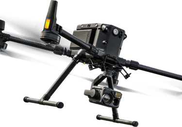
González‑Jorge et al. (2017) define UAS as comprising aerial platforms, payloads (cameras, GNSS/IMU, LiDAR), and data-processing workflows. Miniaturization of high‑accuracy sensors (e.g., RTK/PPK GNSS, lightweight LiDAR) enables centimetre-level accuracy (González‑Jorge et al., 2017). Tkáč and Mésároš (2019) highlight the integration of photogrammetric sensors and real‑time imagery-sharing capabilities in site‑wide aerial surveying, enhancing communication and planning (Tkáč & Mésároš, 2019, p. 27–37).
2.2 Photogrammetry & SfM
Structure‑from‑Motion (SfM) paired with Multi‑View Stereo (MVS) is widely used to derive dense point clouds and digital surface models (DSMs) from overlapping RGB imagery. This approach can approach LiDAR accuracy if flight parameters (altitude, overlap, GCP placement, GNSS control) are properly configured (Kršák et al., 2025; Barrile et al., 2020a). Kršák et al. (2025) reported vertical accuracies under 5 cm in real-world UAV–SfM terrain models (ScienceDirect, 2025).
2.3 UAV‑Mounted LiDAR
LiDAR-equipped UAVs excel in vegetated or complex terrain and deliver superior vertical penetration and precision. When combined with accurate GNSS/IMU systems and ground control, studies confirm that drone‑LiDAR can rival traditional total‑station benchmarks (Tkáč & Mésároš, 2019; Kršák et al., 2025).
3. Accuracy: Assessment, Modeling, Protocols
Barrile et al. (2020a) explored predictive modeling for UAV survey accuracy in Agriculture, finding key flight and processing variables (altitude, coverage, software settings) significantly influence reconstructed precision using Agisoft Metashape (openreviewhub.org, 2023).
The open-source review by Kršák et al. (2025) corroborated vertical errors consistently under 5 cm in well‑controlled photogrammetric surveys (ScienceDirect, 2025).
Shakhatreh et al. (2018) emphasize that despite the high‑data potential, accuracy and reliability depend on rigorous protocols, quality hardware, operator training, and validation against ground truth (Shakhatreh et al., 2018).
4. Applications in Civil Surveying
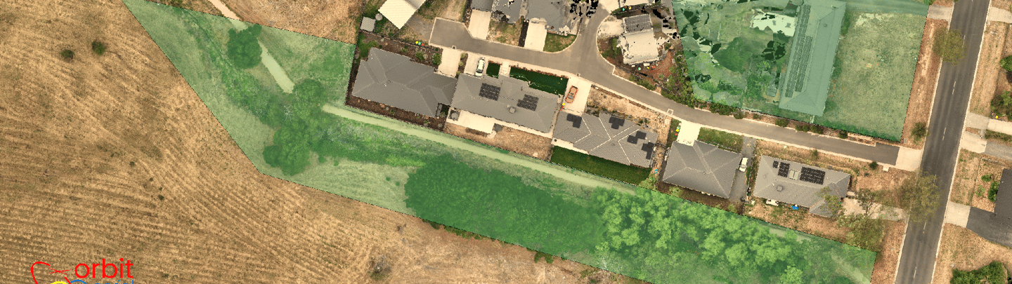
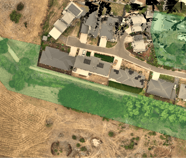
4.1 Topographic & Volumetric Mapping
Drones are heavily utilized in earthworks, site grading, quarry monitoring, and volumetric calculations. Drone-derived DSMs/DTMs enable site-wide quantification and longitudinal monitoring with accuracy sufficient for engineering planning (RICS, 2024; Davis et al., 2025). RICS (2024) points out the tool is viable across geospatial, environmental, and construction surveying domains but stresses careful compliance (RICS, IP2).
4.2 Construction Monitoring & BIM Integration
A 2025 quasi‑experimental study (Choi et al.) evaluating drone‑BIM integration concluded: compared to manual methods, drone‑BIM workflows reduced mapping error by over 80% and survey times from days to hours, with statistically significant improvements (p < 0.001; CEST, Vol. 1 No. 1, 2025). Regression analysis explained 89% of efficiency variance by the drone-BIM method (Choi et al., 2025).
4.3 Infrastructure Inspection & Geotechnical Use
Sinha’s (2023) systematic review shows drones are widely used in structural inspection (bridges, dams, roads), real‑time site monitoring, and geotechnical hazard mapping, with thermal/multispectral and LiDAR sensors supporting early defect detection and 3D visualization (Sinha, 2023).
Geohazard monitoring using UAVs (e.g., landslides) leverages repeat photogrammetry and point-cloud differencing to capture deformations and risk evolution (SciELO, 2024).
5. Efficiency, Costs & Benefits
Drone-based surveys significantly reduce field crew hours—mapping hundreds of hectares in hours versus days (UAVSurveys.info, 2024). The RICS review notes as much as 30% time savings (RICS, IP2).
Cost‑benefit studies show drone methods often cut overall project cost by 50% or more compared to traditional total‑station and manned-aircraft surveys, especially at scale (UAVSurveys.info, 2024). Real-time imagery sharing and reduced human exposure to hazardous terrain support both project control and safety (Tkáč & Mésároš, 2019).
6. Limitations & Challenges
6.1 Environmental & Operational Constraints
Environmental conditions (wind, lighting, GNSS signal loss, vegetation coverage) can degrade survey quality. Additionally, battery life limits coverage per flight, requiring efficient mission planning (UAVSurveys.info, 2024; Tkáč & Mésároš, 2019).
6.2 Regulatory & Professional Compliance
RICS (2024) stresses strict adherence to local aviation rules, pilot licensing, and operator certification; deliverables must comply with geo‑accuracy standards and often need professional surveyor endorsement (RICS, IP2). Differences in regulation across countries add complexity (Shakhatreh et al., 2018).
6.3 Data Processing & Workflow Integration
High-resolution imagery and dense point clouds create substantial data processing demands. Integration into CAD/GIS and BIM systems requires specialized software and skilled operators (Choi et al., 2025; openreviewhub.org, 2023).
7. Emerging Trends & Research Directions
7.1 AI, Automation & Swarming
Shakhatreh et al. (2018) and Nguyen et al. (2020) explore autonomous drone systems capable of exploratory mapping, object detection, and mission planning. Nguyen et al. (2020) demonstrated autonomous 3D mapping in a construction site scenario using multimodal sensors and path planning (Nguyen et al., 2020).
7.2 Multi‑Session LiDAR Mapping & SLAM
Border et al. (2023) introduced “Osprey,” an autonomous multi-session UAV that uses LiDAR-SLAM and Next-Best-View planning to produce comprehensive maps of industrial sites—automating coverage across flights (Border et al., 2023).
7.3 Standardization & Accuracy Prediction
Research such as Barrile et al. (2020a) aims to build predictive models for expected survey error based on mission parameters, aiding practitioners in planning and standardizing methodologies (openreviewhub.org, 2023).
8. Conceptual Framework & Critical Research Gaps
While many studies validate drone photogrammetry and LiDAR as accurate for civil surveying, gaps remain:
Few standardized validation protocols exist for certification and cross‑study comparison.
Most drone‑BIM research remains in early pilots; large-scale real‑world empirical performance data is limited (Choi et al., 2025).
Integration of outputs into traditional CAD/BIM and GIS remains manual and labor-intensive.
Barriers to adoption include operator skill, regulatory complexity, and upfront equipment investment (Choi et al., 2025; Tkáč & Mésároš, 2019).
9. Summary & Outlook
Civil surveying today benefits substantially from commercial UAV technology, especially when using SfM photogrammetry or LiDAR sensors paired with RTK/PPK GNSS and quality control. When flown and processed under rigorous protocols, drone surveys can achieve centimetre-level vertical/horizontal accuracy (Barrile et al., 2020a; Kršák et al., 2025) and major time and cost efficiencies (Choi et al., 2025; UAVSurveys.info, 2024).
However, realizing full operational and professional adoption requires:
Standardized accuracy assessment and validation protocols.
Robust workflows and software integration with CAD/BIM/GIS platforms.
Training frameworks to up-skill survey professionals.
Coordinated regulatory frameworks that balance safety, privacy, and innovation.
With continued advances in autonomy, sensor integration, AI feature extraction, and validation modelling (Nguyen et al., 2020; Border et al., 2023; openreviewhub.org, 2023), drone surveying in civil engineering is poised to become mainstream. The technology has matured to the point that when used responsibly and in compliance, it can deliver high‑quality data at scale—with transformative impact on surveying and construction practice.
References
Barrile, V., Bilotta, G., Fotia, A., & Bernardo, E. (2020a). Measurement accuracy assessment in 3D models derived from drone surveys. WSEAS Transaction on Environment and Development, 16, 633–642. (as cited in OpenReviewHub, 2023).
Border, R., Chebrolu, N., Tao, Y., Gammell, J. D., & Fallon, M. (2023). Osprey: Multi‑session autonomous aerial mapping with LiDAR‑based SLAM and next best view planning.
Choi, W., et al. (2025). The use of drones for surveying and 3D modeling in construction projects. Civil Engineering Science and Technology, 1(1), 34–44.
González‑Jorge, H., Martínez‑Sánchez, J., Bueno, M., & Arias, A. P. (2017). Unmanned aerial systems for civil applications: A review. Drones, 1(1), 2.
Kršák, B., et al. (2025). Land surveying with UAV photogrammetry and LiDAR for … ScienceDirect.
Nguyen, H., Mascarich, F., Dang, T., & Alexis, K. (2020). Autonomous aerial robotic surveying and mapping with application to construction operations.
RICS. (2024). Drones: Applications and compliance for surveyors (Practice Info). Royal Institution of Chartered Surveyors.
Sinha, T. (2023). In the field of civil engineering, drones and unmanned aerial vehicles: Review article. Civil‑Structural Engineering Journal.
Shakhatreh, H., Sawalmeh, A., Al‑Fuqaha, A., et al. (2018). Unmanned aerial vehicles: A survey on civil applications and key research challenges.
Regulatory Requirements for Commercial Drone Surveying in Australia
1. Governing Legislation: CASA & CASR Part 101
Commercial use of drones—referred to as Remotely Piloted Aircraft Systems (RPAS)—is regulated under Part 101 of the Civil Aviation Safety Regulations 1998 (CASR Part 101), governed by the Civil Aviation Safety Authority (CASA) (CASA, 2024, “Part 101 of CASR”) These rules distinguish between recreational use (model aircraft) and commercial or business operations, with significantly tighter compliance requirements for the latter.
2. Drone Registration & Operator Accreditation
Drone registration is mandatory for all drones weighing over 250 g used in commercial activities, regardless of weight, including aerial photography, mapping, LiDAR scanning, and site inspections (CASA, 2024)
Operator accreditation: Individuals flying drones commercially (e.g. selling imagery, surveying, site inspection) must hold a free RPA Operator Accreditation valid for three years, renewed via the CASA‑managed ‘myCASA’ portal (CASA, 2024)
3. Pilot Licensing & Operator Certification
Remote Pilot Licence (RePL): Required for individuals flying RPAS over 2 kg commercially (except limited operations on own land), these licences are weight‑ and type‑specific and require successful completion of both theory and practical training (CASA, 2024)
Remote Operator Certificate (ReOC): Businesses conducting commercial drone operations need a CASA-issued ReOC, which mandates establishment of an operations manual, Safety Management System (SMS), and designated Chief Remote Pilot oversight (CASA, 2024)
Application processing can extend up to 70 business days and involves formal documentation and evaluations (CASA, 2024)
4. Standard Operating Conditions
Commercial drone operations are subject to CASA’s Standard Operating Conditions, unless exemptions or specific approvals are obtained. Key restrictions include:
Maximum altitude of 120 m (400 ft) AGL
Visual Line of Sight (VLOS) operation only
No flight above populous areas or closer than 30 m horizontally to people, buildings, or vehicles
No operations within 5.5 km of controlled airports without approval
Separate rules for flying over private property or in urban settings—property owner consent is required (Piper Alderman, 2024; CASA, 2024)
These conditions are mandatory unless operating under specific approvals (CASA, 2024)
5. Beyond Visual Line of Sight (BVLOS) & Special Permissions
Currently, CASA requires operators to seek specific approvals for BVLOS operations—common in large-scale agricultural and regional surveying (CASA, 2024) consultation.casa.gov.au+2consultation.casa.gov.au+2. Feedback from industry highlights significant procedural burdens and delays in obtaining BVLOS clearance; CASA is exploring area‑based permits and streamlined approval workflows (CASA, 2024) hoveruav.com.au+1.
6. Penalties & Insurance Considerations
Operating commercially without drone registration, operator accreditation, or required licences can incur fines up to AUD 11,100 and potential criminal charges (Sprintlaw, 2025; CASA, 2024)
Insurance providers—such as QBE—may deny coverage if an operator fails to comply with CASA rules regarding licensing and registration (QBE, 2024) QBE DEV+1.
7. State and Local Restrictions & Privacy Laws
Beyond federal CASA mandates, operators must observe state, territory, or local regulations, such as local council rules for parks, heritage sites, or near correctional facilities (Sprintlaw, 2025; Piper Alderman, 2024)
Privacy laws may govern aerial surveillance and data collection, requiring operators to respect privacy and avoid capturing images where individuals have a reasonable expectation of privacy (Piper Alderman, 2024; LexisNexis, 2024)
8. Application to Civil Surveying Practice
For civil surveyors using drones in Australia, the regulatory compliance framework means:
Register all commercial RPAS, regardless of size.
Obtain operator accreditation (RePL) if flying commercially, and ReOC certification as a company.
Ensure operations comply with Standard Operating Conditions—for example, avoid populous areas without exemption, maintain 30 m distance, operate VLOS within altitude limit.
Ensure flight plans, operational records, safety protocols, and manuals are maintained per CASA requirements.
For BVLOS surveying in regional or large-scale areas, seek special CASA approvals; apply early and plan for procedural lead times.
Obtain public liability insurance that reflects CASA‑compliant operation to avoid denial of claims.
Example Surveying Use-Case Summary Table
Scenario Required Compliance
Site ground control / cadastral survey Drone registration, RePL, ReOC, standard conditions (VLOS, ≤120 m altitude, ≥30 m buffer)
Survey over private land (>2 kg drone) RePL, ReOC if paid work; property consent; standard conditions
Urban infrastructure or topographic survey Same as above, plus cannot fly over populous area unless approved
Large-scale rural / agricultural BVLOS RePL, ReOC, plus CASA BVLOS approval, risk assessment, SMS
Summary
In Australia, commercial civil surveying using drones operates under a multi-tiered regulatory system administered by CASA under CASR Part 101. The system mandates:
Drone registration for commercial use
Individual pilot accreditation (RePL) and corporate operator certification (ReOC)
Compliance with Standard Operating Conditions, including altitude, VLOS, spatial buffer, and restricted airspace rules
Permits for BVLOS operations where necessary
Adherence to privacy and local site-by-site restrictions
Robust documentation, SMS, and liability coverage aligned with CASA approval
These regulations ensure that drone use in civil surveying is safe, professional, and compliant, thereby facilitating high-accuracy data capture while mitigating legal and public risk.