How Orbital Aerial Transformed a Construction Project with Drone Technology
At Orbital Aerial, we specialise in aerial solutions for real estate, construction, agriculture, events, and more. Whether you need high-resolution mapping, inspections, or cinematic aerial visuals, we deliver precision and professionalism.
Ahsan
2/20/20251 min read
In the fast-paced world of construction and infrastructure, efficiency, accuracy, and safety are paramount. Recently, Orbital Aerial was approached by a construction firm facing a major challenge—they needed an efficient way to monitor site progress, track material stockpiles, and identify potential safety hazards, all while minimising costs and reducing on-site disruptions.
By leveraging cutting-edge drone technology, we provided a tailored aerial solution that streamlined their operations and improved decision-making. Here’s how we did it.
The Problem: Inefficiency and Limited Visibility
The client, a leading construction firm working on a large-scale commercial development, was struggling with:
- Frequent delays due to inefficient site monitoring.
- Limited visibility of stockpile levels, leading to material shortages.
- Manual inspections that were slow, costly, and posed safety risks.
They needed a cost-effective, time-saving solution that could provide accurate, real-time data without disrupting site activities.
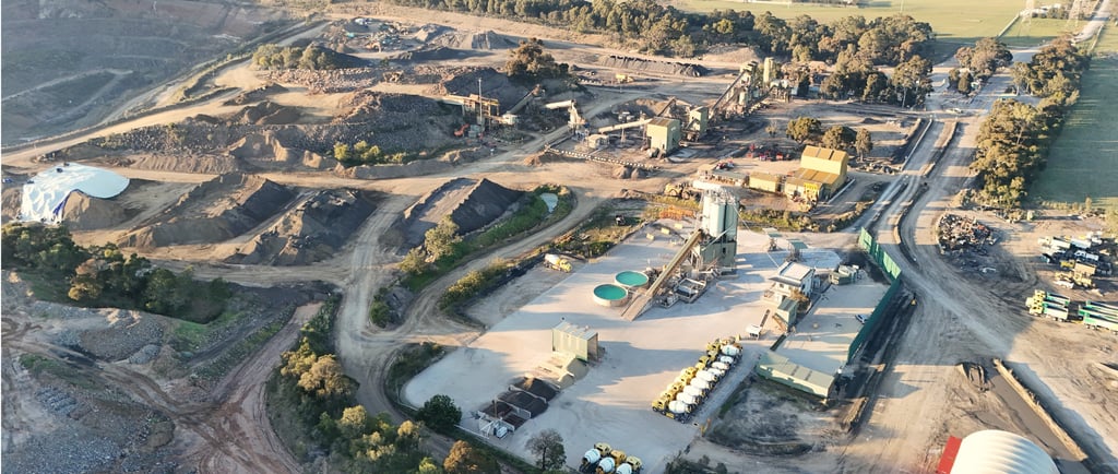
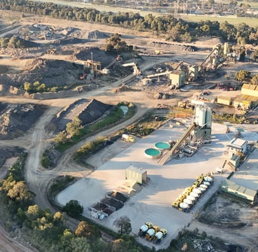
The Orbital Aerial Solution: Precision Drone Surveys & 3D Mapping
After assessing the site’s needs, Orbital Aerial deployed state-of-the-art drones to capture high-resolution aerial imagery and 3D site maps. Here’s how our solution made an impact:
- Aerial Progress Monitoring – Our drones provided weekly site updates, giving project managers a bird’s-eye view of progress. This eliminated the need for multiple in-person site visits.
- Stockpile Volume Calculations – Using drone-based photogrammetry, we delivered accurate material stockpile measurements, preventing unexpected shortages and optimising inventory management.
- Safety & Hazard Detection – We used drone imagery to identify potential safety risks, allowing the team to take preventive measures before incidents occurred.
The Results: Increased Efficiency & Cost Savings
Our drone-based approach delivered tangible benefits:
- 50% reduction in manual site inspections, saving time and labour costs.
- Accurate stockpile tracking, preventing delays and material waste.
- Improved project oversight, allowing managers to make informed decisions faster.
- Safer site conditions, with early hazard detection reducing risks to workers.
One of the project managers remarked:
"The drone footage and reports provided by Orbital Aerial completely changed how we track progress. The accuracy, speed, and ease of access to data have been game-changers for us."